According to the Alma, Wisconsin website, this unique town is located on State Highway 35, (the Great River Road), along the upper Mississippi River in western Wisconsin, only 90 miles south of Minneapolis/St. Paul, 55 miles north of La Crosse, Wisconsin, or 325 miles northwest of Chicago.
The website says that Alma's "setting between the Mighty Mississippi and the 500-foot limestone bluffs gives Alma a unique look and feel. Alma is a quaint river town, established in 1848 and is listed on the National Register of Historic Places."
Buena Vista Park is one of the must-sees of Alma local attractions. We hiked the nature trail that leads up to Buena Vista Park. The Alma local attractions website says "this scenic vista 500 feet above Alma and the Mississippi River Valley has a natural viewing platform. Visitors can watch barges traveling up the river and locking through Lock & Dam #4 along with views of the sand islands and backwater areas". Here are a couple shots we took from the top, an aerial view of the upper Mississippi River Valley and Lock & Dam #4:
 On Hwy 35, right off the main street of Alma, you can access a platform adjacent to the lock and dam where you can stand and watch boats entering and leaving the lock (I've included a picture below). The website says "An average of 175 million tons of freight moves on the Upper Mississippi each year. One barge will hold an average of 1500 tons, which equals the tonnage of 15 railroad cars or 58 semi trucks. The lock is 600 feet long by 110 feet wide and raises and lowers traffic 7 feet..."
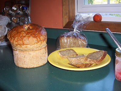
Although extemely small, Alma has a diverse offering of downtown shops, including art, pottery, flowers, restaurants, and a local bakery. Here are the fancy
Wilder Rice and
Halsa Breads we bought at the
MadBaker of Main Street.
When leaving Pepin, if you continue a few miles on Hwy 35 south to Nelson, be sure to stop at the
Nelson Cheese Factory for ice cream. (They also have great food).
We continued on Hwy 35 for about 10 more miles to
Pepin, which is known as the birthplace of Laura Ingalls Wilder. Here is a view of Lake Pepin, taken from the deck of the
Pickle Factory restaurant, where we enjoyed a delicious meal (
Harbor View Cafe in Pepin is also one of my favorite restaurants). The
Pepin website says that Lake Pepin is "formed by the delta of Wisconsin's Chippewa River," and that it is "a 28-mile-long, three-mile-wide natural waterway that is part of the Mississippi River."

Walk out on the pier, and you almost feel like you're on vacation...

And to think, all this beauty is only one small section of the
Great River Road, which runs along both sides of the Mississippi. The
seventy-mile Lake Pepin "circle route" is a fabulous drive, with historical markers, scenic overlooks and other attractions of the Mississippi River valley.


